How we choose to map the world can be subjective. Having a Grid Lines, Where to put the Prime Meridian, How to project a sphere going through space onto paper is a subjective exercise. Look at these examples.
 Mercator Projection
 Gall-Peters Projection
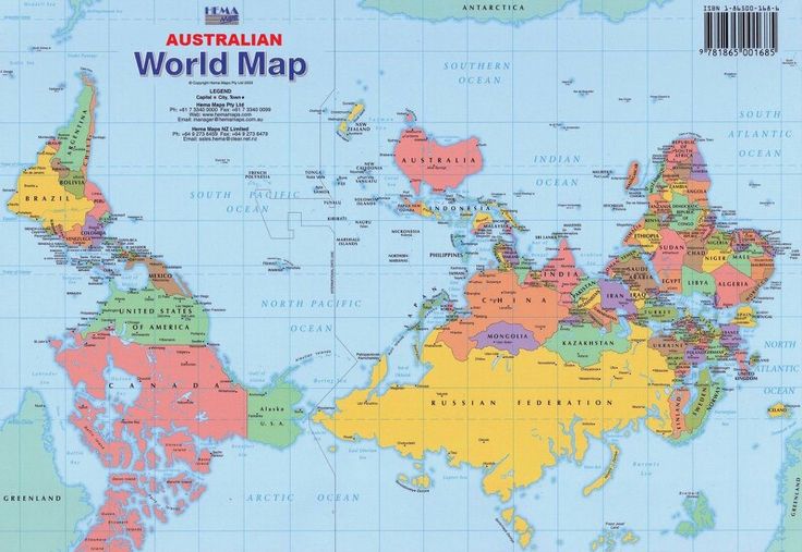 Australia on top

Europe off to the side
Mercator ProjectionGall-Peters ProjectionAustralia on topEurope off to the side

1. file:///Users/k.roncadin/Desktop/brights-mercator-political_lg.jpg
ReplyDelete2. australian-world-map.jpg
3. 1024px-Mercator_projection_SW.jpg
4. 1280px-Gall–Peters_projection_SW.jpg
5. data=RfCSdfNZ0LFPrHSm0ublXdzhdrDFhtmHhN1u-gM,v61qI3q-5hG7Mvfn-eX-j5-WFAJtQCrNZIgxL9rRAniEdpUdaJdoBg8_g914tk_skP_rWNk-h0lWkl8NK0zJbzfxKgBTRalHEvc0xyxfCeQO.png
azimuthal https://upload.wikimedia.org/wikipedia/commons/2/2f/Lambert_azimuthal_equal-area_projection_SW.jpg
ReplyDeleteequal area http://www.physicalgeography.net/fundamentals/images/mollweide.gif
equidistant http://www.sfu.ca/~harrism/Second.png